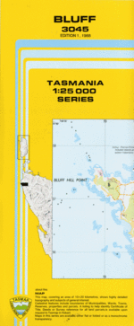
TAS 3045 – Bluff Sale
Description
This Topographic Map is produced by the Department of Primary Industries, part of the Tasmanian Government.
These maps are an important resource for Government, industry, and the public. They are used for environmental and emergency management, farm planning and mineral exploration. They are also popular for recreational users such as bushwalkers, mountain bike and horse riders.
The PDF version of this can be printed at home or sent to a professional printer for a 100% scale reproduction.
At this scale, 4cm on this map represents 1km on the ground. A standard map (which is square) covers an area of approximately about 12.5km by 12.5km, with a contour interval of 10m. This map contains natural and constructed features including road and rail infrastructure, vegetation, hydrography, contours, localities and some administrative boundaries.
Arthur River Adelaide Creek Alert Creek Arthur River Bridge Australia Point Big Bend Bluff Hill Bluff Hill Lighthouse Bluff Hill Point Brooks Ridge Callaghans Scrub Church Rock Elver Falls Gardiner Point Home Creek Jim Crowe Scrub Johnsons Creek Lovells Creek Mawson Bay Myhill Creek Nimble Creek Prickly Wattle Lagoon Richardsons Creek Richardsons Flats Salmon River Sawards Creek Sky Creek Toomey Creek Victor Creek Warra Creek Black Rocks Church Cove Kings Run Private Nature Reserve Lovells Creek Forest Reserve Warra Creek Forest Reserve Bluff Head Point Bluff Point Buff Hill Point Frankland River
Additional Information
| Title | Pdf Download |
|---|
Related products


lifemanhattanus.shop © 2025 All Rights Reserved