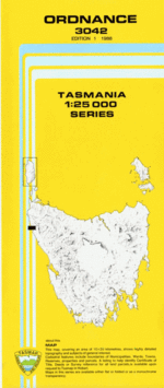
TAS 3042 – Ordnance Fashion
Description
This Topographic Map is produced by the Department of Primary Industries, part of the Tasmanian Government.
These maps are an important resource for Government, industry, and the public. They are used for environmental and emergency management, farm planning and mineral exploration. They are also popular for recreational users such as bushwalkers, mountain bike and horse riders.
The PDF version of this can be printed at home or sent to a professional printer for a 100% scale reproduction.
At this scale, 4cm on this map represents 1km on the ground. A standard map (which is square) covers an area of approximately about 12.5km by 12.5km, with a contour interval of 10m. This map contains natural and constructed features including road and rail infrastructure, vegetation, hydrography, contours, localities and some administrative boundaries.
Driftwood Cove Brooks Creek Buckby Creek Dawson Bay Dawson River Greenes Creek Greenes Point Gannet Gulch Gannet Point Grace Creek Hazard Bay High Rock Ingram Bay McLeod River Murray Creek Ordnance Point Parallel Reef Possum Creek Proudfoot Creek Schramms Cove Smiths Gulch Symes Creek Thornton River Dawson Bog Stony Creek Symes Bay Ordinance Point
Additional Information
| Title | Pdf Download |
|---|
Related products


lifemanhattanus.shop © 2025 All Rights Reserved