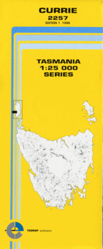
TAS 2257 – Currie For Sale
Description
This Topographic Map is produced by the Department of Primary Industries, part of the Tasmanian Government.
These maps are an important resource for Government, industry, and the public. They are used for environmental and emergency management, farm planning and mineral exploration. They are also popular for recreational users such as bushwalkers, mountain bike and horse riders.
The PDF version of this can be printed at home or sent to a professional printer for a 100% scale reproduction.
At this scale, 4cm on this map represents 1km on the ground. A standard map (which is square) covers an area of approximately about 12.5km by 12.5km, with a contour interval of 10m. This map contains natural and constructed features including road and rail infrastructure, vegetation, hydrography, contours, localities and some administrative boundaries.
Coverlea Woodford Currie Badger Box Creek Badger Box Creek Nature Reserve Bell Hill Big Beach British Admiral Beach British Admiral Reef Burgess Bay Camp Creek Clevelands Lagoon Currie Golf Course Currie Harbour Currie Light Currie Lightkeepers Residence H … Dead Sea Devils Gap Devils Rock Dirty Bay Gull Rock Halfmoon Bay Haystack Hill Huxley Hill Johnson Rock Les Moss Park Lily Lagoon Lions Park Little Beach Mary Hill Memorial Rock Netherby Bay Netherby Point Nugara Peerless Point Sandfly Beach Stingray Bay Sunken Rocks Swan Lagoon Three Rivers Creek Waterwitch Reef Lily Lagoon Nature Reserve Three Rivers Three Rivers Bay Currie Lightkeepers Residence Historic Site
Additional Information
| Title | Pdf Download |
|---|
Related products


lifemanhattanus.shop © 2025 All Rights Reserved